Archives 2023

Onto Columbus, MS where Carol is off to Boston for a few days and “the village” lends a hand; Beautiful White Cliffs of Epes in Alabama

Days 177 – 181; Nov 13 – 17: Monday, 11/13 we were up around 7:00 am, giving our weary friends a glimpse of the anchorage they entered after dark. After calling the lock, we pulled anchor and were off a little before 8:00 am to get through Aberdeen lock, about an hour away, before a tow got there before us. The lockmaster agreed to lock us through before the tow, saving us about an hour of wait time. Check out the below for what it’s like cruising the Tenn-Tom.

Tenn-Tom cruising

We arrived at the marina in Columbus, MS around noon; Steve, the owner, did an awesome job calling us in one at a time and getting us docked.

We were pleased to run into Kim Russo (director of the AGLCA) and her partner Michael Martin aboard ‘The Perch’ as well as Brent and Sarah Bowlin and their children Mary Grace and Miller aboard ‘Light and Salty.’ Both families are liveaboards. Side story – why is the boat named The Perch?….. because their boat is also home to Mike’s cockatoo Margo! Kim is not as much of a fan….her boat (a runabout in Charleston) is called Freebird! Relative to “Light and Salty,” this is a reference to the Bible and book of Matthew, chapter 5 verses 13 and 14 that reference the “salt of the earth” and the “light of the world.” There is always a great story behind a name!

Carol had a couple meetings in the afternoon and Gary was pleased that his shipment of 25 gallons of oil and oil filters arrived – he’d use that to change the oil (11 gallons per engine) in Demopolis, AL on Wednesday. Monday nights dinner was at Harvey’s, the top recommendation by Steve, with the crews of The Perch, Light and Salty, Saga, Lil Sudden and of course, Legacy.

Table for 14! 5 looper boats!

Tuesday morning the alarm bell went off at 3:45 am for Carol to be up and out by 5:00 am to get a car to the airport for a flight at 6:15 am to Boston for 2 days of meetings. Gary and our flotilla left Columbus around 9:00 am with Mayli on board Legacy to help with the locks, arriving at Upper Cooks Bend Anchorage around 4:30 pm. Great job by Annette and Michael on Saga helping out with the locks! This was the day we crossed into Alabama from Mississippi. Mayli and Boris made Bratwurst for dinner while Gary made old bay fries.

Temperatures dropped overnight and the rain came down. Wednesday was up and out by 6:00 am, before the sun was up, again to beat a tow to the lock and get through. Mayli again helped on Legacy, Saga rafted to Legacy in the lock and Mayli jumped back on her own boat after the lock. It was another long run (60+ miles) to Kingfisher Bay Marina in Demopolis, AL, arriving around 1:15.

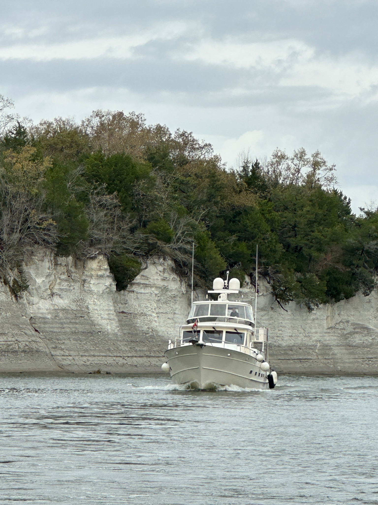
This was one of the more scenic days on the Tenn-Tom passing through the White Cliffs of Epes. The White Cliffs of Epes proved to be a beautiful break from the somewhat monotony of the river. Weather was overcast making the cliffs a bit gray versus bright white. This striking mile of white cliffs provides a window into what Alabama was like during the time of the dinosaurs. Similar to the chalk that makes up England’s famous White Cliffs of Dover, the Alabama version hasn’t earned nearly as much renown.

The chalk began forming in the Cretaceous Period, which began about 145 million years ago. At that time, Alabama would have finally drifted north of the Equator to around the same latitude you find it today. The supercontinent Pangea was in the later stages of breaking apart, creating the Gulf of Mexico and covering most of Alabama with water.

The chalk is a form of limestone, a sedimentary rock deposited when this part of Alabama was still underwater. The rock itself is made up of the remains of single-celled marine organisms and lime-producing algae, which collected in a shallow sea along with the runoff from Alabama’s fast eroding mountains to the east. The tiny shells and plates of the chalk-forming plankton rained down upon the sea floor for many millions of years. Geological studies estimate that every foot of chalk deposit represents about 18,000 years of buildup of those organisms. The exposed cliff face in Epes stands about 80 feet high, meaning about 1.4 million years of marine sediment can now be seen above the Tombigbee water line. The rest is buried underground. Some Alabama chalk formations are more than 500 feet thick, representing at least 9 million years of dead algae and plankton building up on the seafloor.

Back then, the shoreline would have been somewhere around Montgomery, give or take, but would have moved around as global temperatures increased and sea levels rose. Evidence shows Alabama’s so-called “Goat Hill,” where the state capitol building sits, was actually a barrier island in the young Gulf.

Dinosaurs like Appalachiosaurus would have roamed tropical jungles in between the beaches and the mountains. The chalk here also has the distinctive quality that it doesn’t let water through. Water in the Black Belt still tends to pool at the surface rather than filtering through to the deep groundwater beneath the bedrock.

That meant the development of dark, rich soil atop the chalk during the thousands of years after the land dried out. Tall grasses grew on the site for millions of years, and their decomposition created a dark, rich humus that would later prove ideal for cotton farmers.  This soil, built over millions of years, drew European settlers. The area became the heart of the South’s cotton plantations, and the forced import of enslaved African people to work the plantations. Alabama’s Black Belt was among the most valuable in the world during that time.  Much of the fertile dark soil that gave the area its name has weathered away to the chalk bedrock beneath.

The area is still good for growing grasses to support cattle and other livestock, but the massive cotton farms are largely relics of the past. The Black Belt today is instead ideal for catfish farming, with some of the largest operations in the country springing up among the old cotton fields. But the chalk has also made the area ground zero for concerns over environmental racism. Populations in many parts of the Black Belt are among the poorest in the state, and in some cases 90 percent Black. That same impermeable bedrock that made for rich cotton farming until the soil got used up is now attractive for developers of landfills, turning the area into a convenient dumping ground for the rest of the country.

Isn’t if fascinating to look behind the scenes of natural beauty as to its history/roots and ramifications? I’ll stop here leaving you with the image of these beautiful cliffs, but one off the largest landfills in the country right behind it.

Okay end of history lesson and back to the trip….After arriving at the marina in Demopolis, Gary changed the oil in both engines and everyone got their pizza craving satisfied by Dominoes! It was more rain overnight, but atleast a little warmer.

Thursday, 11/16 was another work day for Gary – fixed the TV mount that was stuck down, changed the oil in the generator, reset the nav system in the pilot house that thought we were in FL, got a haircut, got rid of the old oil, figured out how to upload routes from Navionics (navigation app) to Legacy’s Furuno system and figured out how to get local channels on the TV. Wow that was a lot of stuff, but the best was the Navionics to Furuno interface. The first route uploaded to the autopilot included 286 waypoints, meaning 286 turns that would have had to have been programmed or steered manually! YAY!! Lunch was at the Bistro, which was large enough and late enough that no dinner was needed! Carol arrived after 12 hours of travel around 10:00 pm, happy to reunite with the flotilla.

Friday, 11/17 would be the day we also reunited with Coda, after their side trip to Louisville. Steve and Barbara arrived around 9:00 am, filled the fuel tanks and the ‘four musketeers’ we were off again around 10:00 am, right when Carol’s meeting started! We are so thankful for Mayli again helping with the lock while Carol was on the call….. yes there have been a lot of calls in the last couple weeks, but you do what you gotta do!

We dropped anchor in the Edna Bend Anchorage around 2:45 pm after a twisty turny day on the river. The anchorage was literally a bend in the river where you could tuck in and stay out of the way of the tows….barely!

Dinner was Carol and Gary’s version of ‘Marry Me Chicken’ over pasta – yummy white cream sauce with garlic, parmesan cheese, sun dried tomatoes and spinach. So great to see Steve and Barbara again so we celebrated with some Kentucky Bourbon Steve and Barbara picked up in Louisville and light sticks. We also planned our Thanksgiving dinner menu, dividing up the tasks and making sure everyone’s favorites are covered.

Saturday, 11/18 we were treated to Steve’s amazing custom brewed coffees and lattes as well as a fabulous breakfast on Steve’s new grill – homemade hash browns, cheesy omelets and bacon!

It was anchors up at 9:00 am and we are off to Okatuppa Creek – about a 50 mile, 7 hour run. We are all getting a little weary of the boredom of the rivers (we have 3 more nights of anchorages) and looking forward to civilization in Mobile, AL.

We’ve covered lots of ground in November! Orange/mustard color pins represent our travel in November.

Hello Tombigbee Waterway (Tenn-Tom)! Check out the lock with 84’ drop, gorgeous sunsets and story of lost anchor/found dog!

Days 174 – 176; Nov 10 – 12: After 2 days in a marina with full power, water, pump out, courtesy car, marine store and more….. all 3 boats were fully re-provisioned, so we were off! It was lines off at 9:00 am headed down the Tennessee River onto the Tennessee-Tombigbee Waterway to an anchorage at Bay Springs, MS.

The Tombigbee waterway is an interesting fellow, connecting the Tennessee River to the Tombigbee River.

Popularly known as the Tenn-Tom, it is a 234-mile man-made waterway completed in 1984 at a cost of nearly $2 billion USD. It links commercial navigation from the nation’s midsection to the Gulf of Mexico, providing an alternative to the Mississippi. The Tenn-Tom features 10 locks and dams, each 110’ wide by 600’ long with a total lift of 341 feet. It took 12 years to complete. We’ve heard that compared to the Panama canal’s cost of $375M and 10 years to build, but that was in 1904 – 1913. 5600 people died during that construction project, mostly from malaria. I couldn’t find any safety information on the Tenn-Tom.

So why build this? From Chattanooga, TN it is 1800 miles to New Orleans via the Tennessee, Ohio, and Mississippi Rivers. Shipping costs were high. The Rivers and Harbor Act of 1946 authorized the Corps of Engineers to plan for a canal between the Tennessee and Tombigbee Rivers that could cut that distance by 1000 miles, saving businesses millions of dollars in just a few years. In 1958 Alabama and Mississippi established the Tennessee-Tombigbee Waterway Development Authority. After receiving favorable economic reports, Congress accepted the plans in 1961 but appropriated no funds for another decade.

President Nixon turned the first official spade of earth in May 1971, but the Corps of Engineers had yet to set long-term construction schedules or complete the required environmental studies. The Corps spent more than a decade conducting those studies and refining construction designs.

As planned, the Tennessee-Tombigbee has become a preferred route for transporting large and heavy finished products and raw materials between the Gulf of Mexico and the American heartland. Using the waterway instead of the Mississippi-Ohio River system reduces fuel consumption and lowers shipping costs. But most important (atleast to us) – it made the Great Loop possible!

Our plan over the period of 11/10 – 11/13 was to travel a reasonable amount each day, anchor out (there are very few marinas) and end up in Columbus. MS on 10/13 since Carol needs to fly out on 11/14 for a BOD meeting. First night (Friday, 11/10) was Bay Springs and we found a great anchorage around 1:45 pm. Mayli put out an amazing charcuterie board while looking ‘very yachty’ and later served up corned beef and cabbage for dinner.

Saturday, 11/11 was anchors up at 8:00 am with 3 locks to get through to our targeted destination just north of the Fulton lock. Our first lock (the Jamie Whitten lock) was the tallest on the Tenn-Tom with a drop of 84 feet. Check out the pics below and the time lapsed video of huge doors opening on the Jamie Whitten lock as well as our full descent in the Montgomery lock (only 30’)…. Can you tell I’m playing with a new toy?

Doors opening after 84’ drop
Experience a lock – going down!

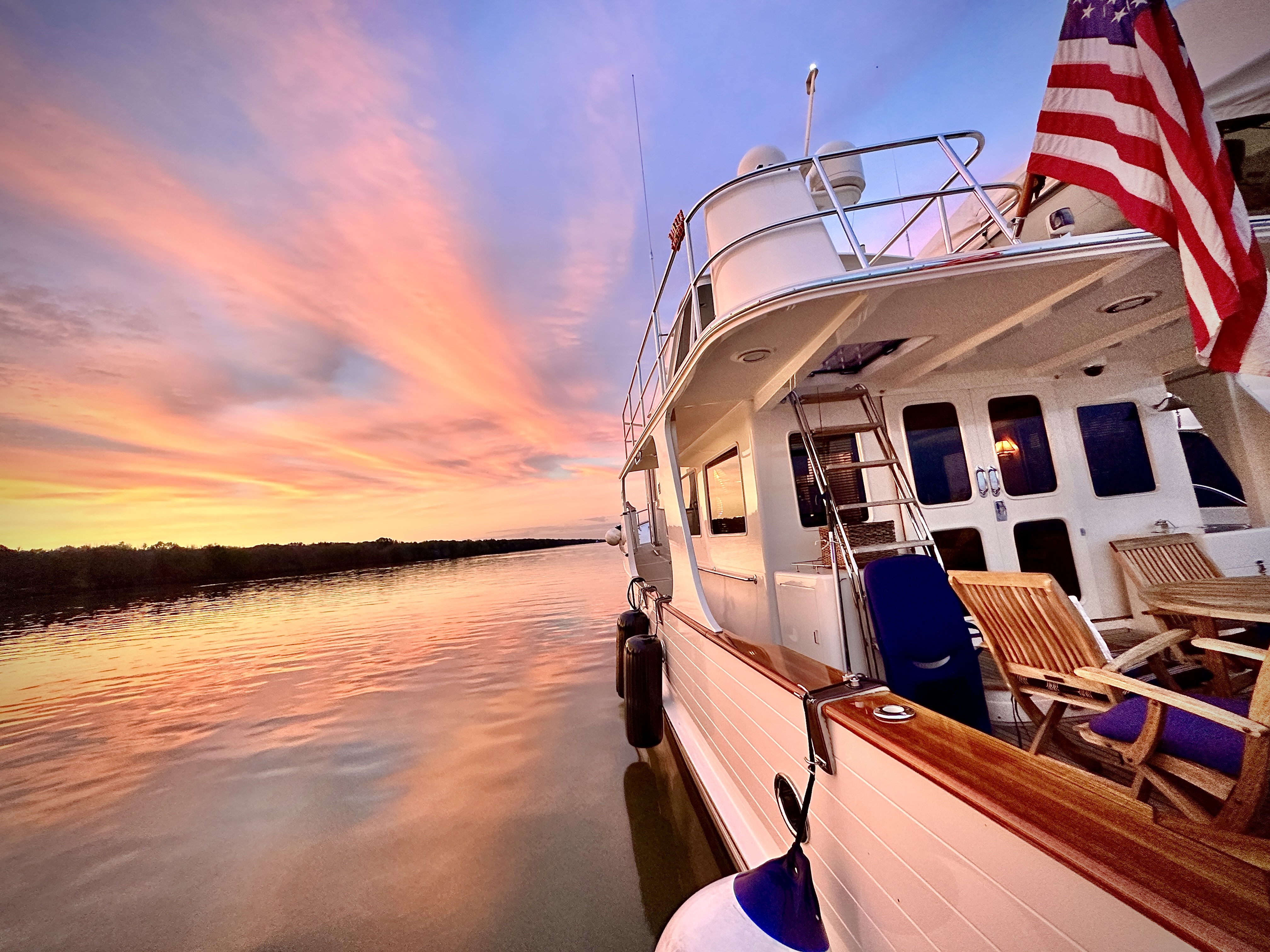
After 3 locks, we found another great anchorage. We were rafted up by 12:30 and watched college football. That called for some fun appetizers and Tonia made an Iowa comfort-food chicken casserole that her Mom used to make for dinner. Most impressive was the amazing colors of the sunset!

11/12 (Sunday) started off as any other day…. We were up and lines off at 7:30 am. Legacy and Lil Sudden separated from Saga, who was the anchor boat, and started down river. Saga called back that as they had the anchor almost all the way up, it separated from the chain….. as in…it just fell off! WHAT?!?! We all turned back, Saga marked where they thought it fell, re-anchored tied to Lil Sudden and we all tried to find the needle in the haystack. Boris got out his diving gear and both Matt from Lil Sudden in Saga’s dinghy and Gary and I in Legacy’s dinghy tried to drag a smaller anchor hoping to snag it. By 10:00 am, Legacy needed to start down river because Carol needs to be on that plane out of Columbus on Tuesday morning. Lil Sudden and Saga stayed behind to search, without success, for several more hours giving up around 2:00 pm…. But that wasn’t until after they had a German Shepard mix puppy swim up to their boat out of no where! Did she fall off a passing boat? Did she swim from land? With no collar…don’t know. They pulled her out of the water, dried her off and gave her some food and water, then took her to the nearby marina hoping they would help to find her owner.

Legacy passed through 3 locks and looked for a safe place to anchor and await the arrival of Saga and Lil Sudden, who would now arrive in the dark, likely around 7:00 pm; it gets dark here around 5:00 pm. Our charts indicated a safe anchorage fairly close to the Aberdeen lock, but with water levels so low, that was a no-go. We ended up backtracking 7 or 8 miles to a safe spot which made the journey a little shorter for our weary friends. All ended well with Gary’s pot roast dinner complete with roasted potatoes, carrots, onions and homemade gravy. They said they could smell it as the entered the cove where we were anchored. We had every light on the boat turned on so they could safely find us and all went well. No pics as they came in, although they looked beautiful all lit up; we were too busy catching lines!

Tomorrow (Monday, 11/13) we will pass through 2 locks on our way to a marina in Columbus, MS…. first marina in 4 days. Carol has a flight out on Tuesday morning at some ungodly hour and Gary will continue with the flotilla arriving in Demopolis on 11/16 where Carol will rejoin them. Then it’s onward down the Tenn-Tom to Mobile, AL where we will all spend a few days celebrating a friends Thanksgiving. At dinner last night, we shared all of our different traditions and favorite dishes….. this is going to be quite the varied smorgasbord!

Below is our progress to date. The yellowish color is November; still a ways to go to get to Mobile and some turkey!

Journey so far…also of 11/11/2023

Tennessee River to Grand Harbor/Pickwick, TN and the Tombigbee Waterway; Amazing visit to Shiloh National Park – site of the bloodiest battle in US History as of that date.

Days 171 – 173; Nov 7 – 9: It was anchors up 10:00 am as we headed up river on the Tennessee River to an anchorage behind Wolf Island, TN arriving round 1:30 pm. We passed many homes up on stilts (Gary says they are properly called piers) of various heights to protect them when the river rises. The rock formations with their striations and layers were interesting in that they weren’t level. We wondered if this was the result of earthquakes in this area in 1811/1812 (magnitude 7.2 – 8.2 with aftershocks up to 7.4)

Water levels seemed low by about 6 feet “from datum” meaning low from the benchmark for measurements for charts and bridge clearances. That’s good for us to get under bridges but bad for the risk of hitting bottom!

It was alarming to see some of the damage from tornados including one that looked very recent – we saw one house where the roof was ripped off and the bedroom furniture still in place. We saw quite a few homes under repair, some just a pile of rubble and others new rebuilds.

Since we were anchored by 1:30 we decided on some work and some play. Mayli and the kids finished up their schoolwork for the day, Carol got some board work done and we had a “sip and paint” afternoon! A great time was had by all as we took our varying degrees of talent and expertise and attempted to recreate a sunset with 3 palm trees! We topped off the night with Mayli and Boris’ beef stroganoff for dinner and Carol’s pineapple upside down cake for dessert!

11/8 (Wednesday) we hauled anchor and were underway by 6:00 am since we had about a 2 hour trip, one lock to go through (the Pickwick Lock and Dam with a vertical lift of 63 feet) and Carol had a meeting she needed to attend from 10:00 am – 12:30. This would be our last lock that we’d travel UP, all the rest will take us back DOWN to the level of the Gulf of Mexico.

We arrived around 9:30 am giving us time to get settled into the marina in Grand Harbor (Pickwick), get the meeting done then we were off with Bill and Mary Routt, who live in Memphis but have a place on Lake Pickwick at the mouth of the Tennessee-Tombigbee waterway.

Bill and Mary were super gracious hosts and we enjoyed 2 days wtih them including lunch at the Catfish Hotel, a tour of the Civil War battlefields at Shiloh and Corinth, dinner at The Outpost and lunch at the old Borrum Drug Store and Soda Fountain – the oldest drug store in continuous operations started at the end of the Civil War. Bill taught us how to eat catfish and we learned these small edible catfish are called “fiddlers.” When he ordered a whole catfish, we envisioned some monstrous thing being brought to the table but learned those huge catfish (+30 lbs) people post pics of that they caught are just released – not edible! Can‘t thank Bill and Mary enough for such a great couple days! Their southern hospitality was off the charts and we are forever grateful!

Shilo (and the next day visiting Corinth) gave us some amazing Civil War history…. First, we had not realized the armies of the north (US) and south (Confederacy) were organized by state; so each state sent their armies and Generals then coordinated them…. So know that you know that, here is some history:

The American Civil War (April 12, 1861 – May 26, 1865; was fought between the Union (“the North” or “Federals”) and the Confederacy (“the South”). The Confederacy was formed by states that had seceded from the Union. The cause of the war was the dispute over whether slavery would be permitted to expand into the western territories, leading to more slave states or be prevented from doing so, which many believed would place slavery on a course of ultimate extinction.

Decades of political controversy over slavery was brought to a head by the election of Abraham Lincoln to the US Presidency in 1860. Lincoln opposed slavery’s expansion into the western territories. Seven southern states responded to Lincoln’s victory by seceding from the United States and forming the Confederacy. The Confederacy seized U.S. forts and other federal assets within their borders. Four more southern states seceded after the war began. Led by Confederate President Jefferson Davis, the Confederacy asserted control over about a third of the U.S. population in eleven states. Four years of intense combat, mostly in the South, ensued.

By mid-February 1862, United States (Northern/Federal) forces had won decisive victories in the West at Mill Springs, Kentucky, and Forts Henry and Donelson in Tennessee. These successes opened the way for invasion up the Tennessee River to sever Confederate rail communications along the Memphis & Charleston and Mobile & Ohio railroads. Forced to abandon Kentucky and Middle Tennessee, Gen. Albert Sidney Johnston, supreme Confederate commander in the West, moved to protect his rail communications by concentrating his forces around the small town of Corinth in northeast Mississippi – the strategic crossroads of the Memphis & Charleston and the Mobile & Ohio rails.

In March, armies under Maj. Gens. Ulysses S. Grant and Don Carlos Buell moved southward to sever the Southern railroads. Grant ascended the Tennessee River by steamboat, disembarking his army at Pittsburg Landing in Shiloh, 22 miles northeast of Corinth. There he established a base of operations on a plateau west of the river, with his forward camps posted two miles inland around a log church called Shiloh Meeting House. Grant was ordered NOT to engage the Confederates until he had been reinforced by Buell’s Army of the Ohio, then marching overland from Nashville. Once combined, the two armies would advance on Corinth and permanently break western Confederate railroad communications.

General Johnston (Confederacy), looking to defend the southern states control of Corinth, planned to smash Grant’s army at Pittsburg Landing before Buell arrived. He placed his troops in motion on April 3, but heavy rain and difficulties encountered by marching large columns of men, artillery, and heavy wagons over muddy roads, delayed the attack. By nightfall, April 5, his Army of the Mississippi, nearly 44,000 men present for duty, was finally deployed for battle four miles southwest of Pittsburg Landing.

At daybreak, Sunday, April 6, the Confederates stormed out of the woods and assailed the forward Federal camps around Shiloh Church. Grant and his nearly 40,000 men were surprised by the onslaught. The Federals soon rallied, however, and bitter fighting consumed “Shiloh Hill.” Throughout the morning, Confederate brigades slowly gained ground, forcing Grant’s troops to give way, grudgingly, to fight a succession of defensive stands at Shiloh Church, the Peach Orchard, Water Oaks Pond, and within an impenetrable oak thicket battle survivors named the Hornets’ Nest.

Despite having achieved surprise, Johnston’s troops soon became disorganized. The Southern attack lost coordination as corps, divisions, and brigades became entangled. Then, at mid-afternoon, as he supervised an assault on the Union left, Johnston was struck in the right leg by a stray bullet and bled to death, leaving Gen. P.G.T. Beauregard in command of the Confederate army. Grant’s battered divisions retired to a strong position extending west from Pittsburg Landing where massed artillery and rugged ravines protected their front and flanks. Fighting ended at nightfall.

Overnight, reinforcements from Buell’s army reached Pittsburg Landing. Beauregard, unaware that Buell had arrived, planned to finish the destruction of Grant the next day. At dawn, April 7, however, it was Grant with fresh troops who attacked. Throughout the day, the combined Union armies, numbering over 54,500 men, hammered Beauregard’s depleted ranks, now mustering barely 34,000 troops. Despite mounting desperate counterattacks, the exhausted Confederates could not stem the stronger Federal tide. Forced back to Shiloh Church, Beauregard withdrew his outnumbered command and returned to Corinth. The battered Federals did not pursue the retreating Confederates. The battle of Shiloh, or Pittsburg Landing, was over. It had cost both sides a combined total of 23,746 men killed, wounded, or missing, and ultimate control of Corinth’s railroad junction remained in doubt.

Union leadership, recognizing Corinth’s military value, considered its capture more important than the destruction of Confederate armies. Reinforced by another army under Gen. John Pope, Union armies advanced southward from Tennessee and, by late May, entrenched three armies within cannon range of Confederate fortifications defending the strategic crossroads. Despite being reinforced by Maj. Gen. Earl Van Dorn’s Trans-Mississippi Army, Beauregard withdrew south to Tupelo, abandoning the most viable line of east-west rail communications in the western Confederacy.

Federal efforts to recover the Mississippi Valley stalled in the late summer of 1862, and Confederate leaders launched counteroffensives in every theater. Armies led by Gens. Braxton Bragg and Edmund Kirby Smith invaded Kentucky, while troops under Van Dorn boldly attacked the heavily fortified Union garrison at Corinth, “linchpin” of Federal control in northern Mississippi. In one of the more bitterly contested battles of the war, Van Dorn was decisively repulsed, following two days of carnage (October 3-4) that claimed nearly 7,000 more Confederate and Union casualties.

Although overshadowed by the failure of Robert E. Lee’s Confederate invasion in Maryland, Van Dorn’s defeat, coupled with Bragg’s retreat from Kentucky after the battle of Perryville (October 8), caused discouragement in Richmond and relief in Washington. More significantly, Van Dorn’s defeat at Corinth—the last Confederate offensive in Mississippi—seriously weakened the only mobile Southern army defending the Mississippi Valley. This permitted Ulysses S. Grant to launch a relentless nine-month campaign to capture “the fortress city” of Vicksburg and recover the Mississippi River.

The civil war would continue for over 3 more years finally ending in May of 1865. By the end of the war, much of the South’s infrastructure was destroyed, especially its railroads. The Confederacy collapsed, slavery was abolished, and four million enslaved black people were freed. The war-torn nation then entered the Reconstruction era in an attempt to rebuild the country, bring the former Confederate states back into the United States, and grant civil rights to freed slaves…. Of course there’s more history to share beyond 1865, but we won’t do that today.

Southbound on Kentucky Lake and the Tennessee River; Glad the weather is warming and enjoying several anchorages

Days 168 – 170; Nov 4 – 6: We left our anchorage in Standing Rock Creek, TN as planned around 10:00 am headed to an anchorage just outside of Birdsong Marina in Camden, TN. Birdsong is a very small marina that didn’t have room for all 3 of us, so we anchored out. It was a tricky entrance to the creek, making a large circle around a shallow area that to the naked eye looked fine, but the charts said otherwise! Lil Sudden only draws 3’ and made it across, seeing as little as 5 feet of water. We took the longer, deeper, more conservative route (as did Saga) since we draw 5 feet. We rafted the 3 boats around 4:30 pm and enjoyed Mayli’s “marry me chicken” over rice.

We had finally found some reasonably warmer weather and shed our layers and jackets, eating outside in the cockpit of Legacy. All the fishing poles came out but alas the fish were elusive and they remained fishing poles vs. catching poles. We enjoyed watching the wild life and were treated to a beautiful sunset.

Sunday, 11/5 we were up and out around 9:00 am. As we enjoyed our coffee and breakfast, we saw 2 loopers go by who had stayed at the Marina and were headed out early. It ended up being a bad day for one of them having decided to go straight across that shallow area instead of around the long way. Hopscotch, a 36’ Grand Banks, was hard aground and working to get back into deeper water using their dinghy, anchor and windlass. They would take the dinghy and drop the anchor in deeper water, then pull the boat with the windlass toward the anchor. They were making progress slowly but surely as we went by. Not much we could do to help without endangering ourselves. Despite losing several hours getting “unstuck,” they seemed to have no damage from the ordeal and arrived at the same anchorage as us that night, a little more tired and a little more wise.

Back to our trip….we ran for a few hours and checked out several creeks along the way that should have been good anchorages, but with the water so low (we are now on the Tennessee River) they were a “no-go” so we continued on. It made for a longer day than we had planned, finally anchoring around 3:00/3:30 pm when we thought it would closer to noon. Not a big deal – it just brought us closer to Clifton which was our planned destination for Monday, 11/6.

Dinner was a team effort inspired by a facebook cooking video Carol had seen on calzones. We made 4 large calzones (1 glutton free for Annette) that included decorating them with dough and veggies that made them quite unique….food art! They were pretty and tasty at the same time filled with tomato sauce, ground beef, Italian sausage, mozzarella cheese, spinach, basil and mushrooms! They were lots of fun and yummy too! Credit for video below to Mayli on Saga!

11/6 (Monday) we were up and out around 8:00 am, headed to Clifton which we expected to be a 2-3 hour run. Carol had meetings all afternoon (2:00 – 6:30) so we were thankful Tonia was making dinner. We arrived around 10:30 am finding a beautiful and spacious anchorage, eager for some leftover Calzones!

Although we continued to observe low water levels (atleast 5 feet below normal) our ride here was pretty uneventful. The threat of rising water and power of the river was clear in the height of the supports under the houses/structures to keep them from flooding when the river rises. The edges of the river were very interesting layers of rock and WOW on the number of stairs to the waters edge!

Tomorrow we are off to Wolf Island, about a 3.5 hour run where we will anchor again…. Then onto Grand Harbor/Pickwick where we have a reservation for 2 days in a marina. We will reprovision there.

Green Turtle Bay Resort (Grand Rivers, KY) to Kentucky Lake and Standing Rock Creek, TN

Days 162 – 168 ; Oct 29 – Nov 4: We arrived at Green Turtle Bay (GTB) Resort in Grand Rivers, KY on 10/29 around 3:15 pm and were grateful to get plugged into power and the heat on, after about a 7 hour run in the cold and rain. Green Turtle Bay is a very nice facility with restaurant, gift shop, bar, spa and courtesy car on site. We stayed 4 nights in GTB, mostly due to a bunch of meetings Carol needed to attend, but it also gave us time for a big provisioning trip to Sam’s Club (first time been in one since we left Annapolis) and Kroger (grocery store) leveraging the courtesy car and rental car that Boris and Mayli rented (SAGA). We go to dog sit for Flash (SAGA) while they took a side trip to Nashville and Gary caught up on tons of paper work and other stuff.

Flash!

Of course Carol made time for a manicure, pedicure, massage and facial – we all have our priorities! Now don’t imagine a 5 star spa like the Ritz or Waldorf Astoria….. imagine a 2 star converted building that gets and “A” for effort with some amazing ladies with southern charm.

The big attraction in Grand Rivers is the Patti’s 1880 Settlement – a destination built around a restaurant that features a 2” thick pork chop and mile high meringue pies, amongst many other things! Okay, so we ate their twice! First time was with the crews of Beachside, Sea No Evil, Into the Mystic, Sundancer, Red Pearl and Coconuts (below); second was with Saga and Lil Sudden. The place is already decked out for Christmas.

Patti’s looks like a rustic 1800’s town but offers modern conveniences – hotel rooms, mini golf, gardens, moonshine shop, other boutiques, ice cream parlor, panning for “precious gems” and more.

A little history: In 1975, Bill and Patti Tullar stopped in Grand Rivers, fell in love with the little town and purchased the Grand Rivers Motel. In 1977, Bill, Patti, Chip and Michael Lee, started Hamburger Patti’s Ice Cream Parlor. The restaurant was part of the building that was the 6-unit motel, but the motel units quickly gave way to becoming dining rooms. The upstairs rooms were the Tullar’s personal living space. Patti’s 1880’s Restaurant was on it’s way.

Bill got tired of being called Mr. Patti, so built a second restaurant in 1990. Mr. Bill’s was designed with added entertainment to accomodate bus tours including Honky Tonk piano players and the hostess and servers dressed in period costumes. Today Mr. Bill’s and Patti’s have the same food, servers, etc, creating quite the compound. The two restaurants, in a tiny town of 350 people, serve over 350,000 people each year with 25% of that happening in November and December due to the extensive Christmas display. We slipped in before the craziness of Christmas kicked in…. We just wished for warmer jackets as the weather hovered in the high 30’s to low 40’s and the town was about a mile walk away. Patti’s will drive you back and forth, which we did take some advantage of, but we also wanted the exercise of the walk after indulging in their offerings.

On 11/1, we celebrated 3 boats crossing their wakes (finishing their loops) with about 30 other loopers. This is also known as “going gold” since you exchange your white burgee for a gold one. Congratulations to Red Pearl, Cavalier and Ottysey. A round of little beers was highlighted by the looper toast, adopted from an old Irish proverb: “There are good ships and wood ships and ships that sail the sea; but the best ships are friendships and may they always be.”

11/3 (Friday) we left GTB on Kentucky Lake around 9:15/9:30 am after all 3 boats pumped out. We were headed to an anchorage in Standing Rock Creek, TN where Matt and Tonia were making chili for dinner and some spirited board games were planned. It was a beautiful, yet chilly evening capped by a pretty sunset. The morning of 11/4 was a leisurely morning with a planned 9:30/10:00 am departure with an approximate 4 hour cruise to an anchorage near Birdsong Marina in Camden, TN. The only excitement came as we untangled the anchors of SAGA and Legacy that had crossed over night as we swung with the wind and current.

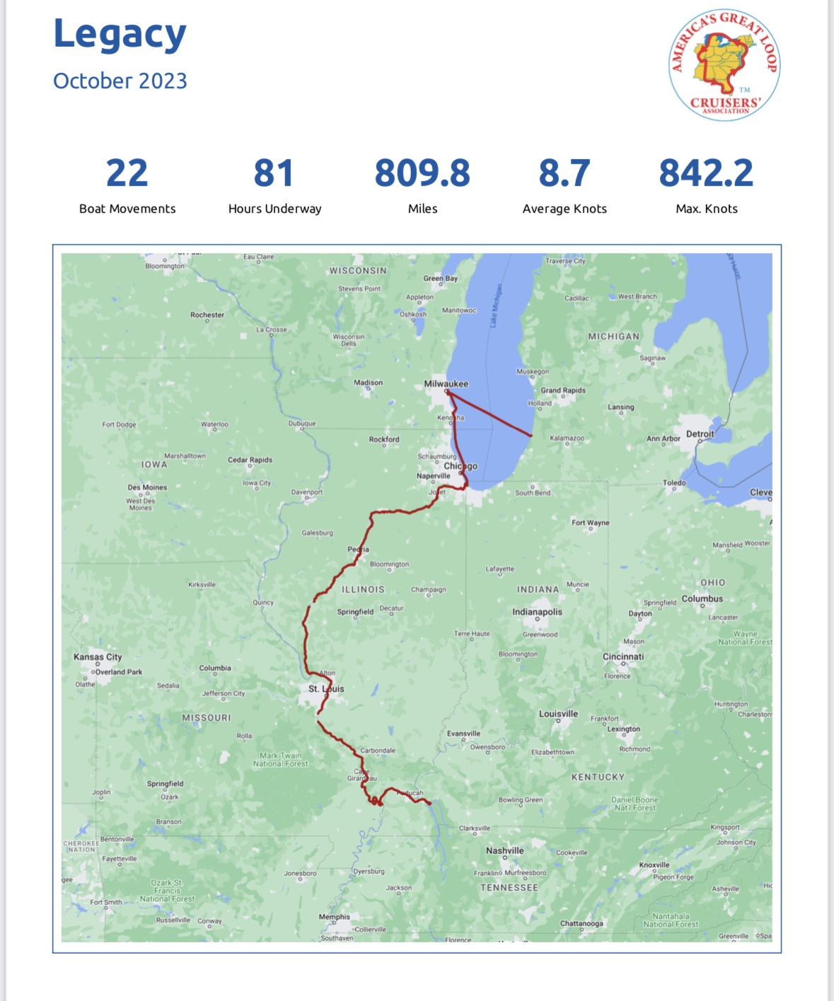
Having crossed into Tennessee, that makes 12 states, 1 Canadian province and 1 foreign country we’ve visited so far. October was a big month of travel, covering a lot of ground (over 800 miles) including crossing Lake Michigan, spending some tourist time in Chicago and finally starting down the river system once the locks were re-opened (see below).

Month of October
October is represented by the purple pins

We are looking forward to getting south to warmer weather. It looks like Thanksgiving will be in New Orleans, but neither Sarah (and Richard) or Michael (and Kylie) can really get away from their responsibilities to join us. We will need to figure something out for Christmas, but didn’t think ahead to bring warm clothes needed for a trip north; all of that is in storage…..Hoping they may be able to come south. Miss them all and would like to share some of this adventure with them.

Little Diversion Canal Anchorage to Paducah (a walled city) onto Green Turtle Bay, KY

Days 159 – 162; Oct 26 – 29: Thursday, 10/26 was anchors up from Kimmswick a little after 8:00 am headed to an anchorage in the Little Diversion Canal, Missouri – about a 7 hour run. It was a cold windy day with white caps on the river. Waves were about a foot with some nearing 2 feet, but nothing worrisome, just cold! We passed Cape Girardeau noting some of the wall built at the banks of the Mississippi as a defense for the rising of the river. It reminded us of the massive flooding of this area in 1993. You could also see how low the water is right now, with the wing dams and embankments quite exposed. See video below; sorry hard to hear me narrate.

We arrived at the Little Diversion Canal around 5:00 pm, in time for dinner and ice cream cake celebrating Mayli’s birthday! The water was super calm although there was a strong current. We rafted the 3 boats with 2 anchors down and set out a stern anchor to keep us in the middle of the channel. There were 2 raft-ups in front of us and one that came in later; total of 12 boats and room for more.

10/27 we left the Little Diversion Canal around 9:00 am headed to the Olmstead lock, where we planned to anchor just north of the lock and go through the lock first thing in the morning. This would be another fairly long day with a 6+ hour run and a transition from the Mississippi River to the Ohio river at a town called Cairo (pronounced Kay-Row). (See video below).

We switched from gaining some speed and fuel efficiency riding the current south to going against the current on the Ohio River; we also had to shift our brains to keep the red markers on the starboard as opposed to on the port when we were on the Mississippi. “Red on Right Returning” is the saying to remember, but you have to know if you are coming or going! Our anchorage was safe but windy, so all 3 boats had anchors out and drag alarms set.

Boris got up early on Saturday (6:30 am) to speak with the lock master as to when our little flotilla of 10-12 boats could pass through the lock. An inquiry at 6:30 ended up in “go time” at 6:31 so we were all hands on deck getting coffee made (priorities!) lines off, anchors up and everyone in the lock. This lock called Olmstead Lock and Dam, took us up 20-25 feet. This is a new lock, only about 5 years old, that replaced 2 aging locks built in 1929.

It was cool to watch a tow come into the lock next to us as we exited. Such a huge set of barges to push. You might wonder why it’s called a “Tow” when they push, not pull the barges. Back in the day they did pull them bury later changed to pushing, but the name “tow” stuck. See below.

Fortunately, this would be a short run to Paducah where we had reservations at the public dock. We arrived in Paducah around lunch time and found it to be an interesting and fun city; It’s a walled city (a rising river defense built after the massive flood of 1937) with beautiful murals on the inside of the Great Wall. The wall did it’s job with no damage to the city in the flood of 1993. In Paducah, we toured the National Quilt Museum, the Paducah Railroad Museum and walked the cute downtown shops finding a great bakery, coffee shop and some great choices for dinner. Check out the details of the quilts below…. These are all totally made of fabric! True works of art!

A little history: Paducah, Kentucky, was named after the Paducah Indians – the largest nation of Native Americans in North America.

The Ohio River, which flows through Paducah, has been both a source of sustenance and a force to be reckoned with. Historically, the town has faced severe flooding, which led to the construction of a flood wall in the 1930s. Paducah’s flood wall is not just a practical measure but also a canvas for art. The city has transformed it into a mural gallery, making it one of the most unique and picturesque flood walls in the United States depicting the town’s history and resilience in the face of nature’s challenges.

Paducah’s history is intertwined with the Clarks. In 1781, George Rogers Clark, the older brother of William Clark of the Lewis and Clark expedition, was granted a tract of land as part of his compensation for his role in the Revolutionary War. This land acquisition was known as the “Clark Grant.” Although George Rogers Clark had rights to the land, over the years he lacked the funds to develop and hang on to them. In 1803, Captain Meriwether Lewis, while on his way to meet William Clark in St. Louis, stopped in Paducah to recruit local volunteers and prepare for their historic journey westward. In 1827, William Clark purchased 37,000 acres from George for $5.00 which became the Pudacah we know today. Why so little money? George had fallen on hard times and as he tried to evade creditors, he transferred ownership of his properties to friends and family members. He died poor, in ill health and frequently intoxicated.

We stayed just one day in Paducah and were off again Sunday (10/29) morning around 8:30 am in the cold and the rain…. I’m not saying just chilly – it’s downright cold! High 30’s/low 40’s!! Very quickly, we left the Ohio River and turned onto the Tennessee River. Not a very pleasant day of travel, we anchored on the north side of the dam for about 1.5 hours waiting our turn to go through the lock. It worked out well since the captains and crew of Saga and Lil Sudden huddled on Legacy to plan out the next several weeks, including the airports Carol needed to fly out of in mid November for board meetings. We also peered into our refrigerators and pantries and came up with all the needed ingredients for dinner – cottage pie to be assembled on Saga and served on Legacy. It takes a village! We transited the Lock at the Kentucky Lock and Dam around 1:30 pm, in the rain. This lock was a big one and took us up 35-40 feet. Upon exiting the lock, we entered the Cumberland River arriving at Green Turtle Bay Resort around 3:15, very cold and very wet.

It was nice to get plugged into power, get the heaters on, take a nice hot shower and settle in with some football and dinner. We will spend 4 nights here while the Seattle crew takes a car trip to Nashville. We’ve been to Nashville several times so will stay behind, dog sit and enjoy the spa and heated pool here. Forecast is cold! High 30’s/low 40’s…..Brrrrrr! We are also excited that loopers we met and hung out with back in Clayton, NY will be arriving tomorrow (Monday) so will catch up with them….We’ve not seen them in a while since they got stuck on the wrong side of the huge storm and waves on Lake Michigan and had to hunker down in Hammond, Indiana for an extra week. Looking forward to hearing of their travels. Friday we are on to Paris Landing/Buchanan, TN.

Good bye St. Louis…. Onward on the Mississippi

Day 157 – 159 Oct 24 – 26: Left Alton as the sun came up, just before 7:00 am; headed down the Mississippi River to Hoppies, a small family run marina which is actually a couple rusty old barges strapped together and secured to land….but they do have power, so that was a pleasant surprise!

Up with the sun!

On the way we passed through 2 locks. The first was the Mel Price lock, named after Illinois Congressman Charles Melvin Price. The lock was newly rebuilt between 1990 and 1994 with a vertical drop of about 15 feet. This is the lock we toured at the National Great Rivers Museum a few days ago. It’s main chamber is 1200 feet long and 110 feet wide with a miter gate down river (in front of us) and a vertical lift gate up river (behind us). What the heck does that mean, you might ask! The miter gate is 2 huge doors and the vertical lift gate is essentially a wall that rises/falls from the bottom of the lock. See the video below for the noises of the lock and how the bollard “sings” and another video below of the vertical lift gate and miter gate in the next lock (the Chain of Rocks Lock).

As we approached the Chain of Rocks canal, an 8.4 mile canal that precedes the Chain of Rocks lock, you can’t miss the big sign that warns you to go to the left for the lock and canal, or you will enter very shallow waters complete with rocks (ergo the name), rapids and other hazards. How can you miss this?

Well some might remember the sailboat that made that mistake in October of 2021. That was a very bad day for them. While the 2 people on the boat were rescued, the boat was lost in a storm over the next couple days as they tried to salvage it. It was never found.

Oct, 2021 Chain of Rocks…. He missed the sign to stay left!

See below for the vertical lift gate in the Chain of Rocks lock. This lock took us down some 8-10 feet.

Just a few miles south of the Chain of Rocks lock, we came upon the long awaited Looper picture opportunity – the boat in front of the Gateway Arch!

Looper Classic shot! Thank you Mayli!

I’d be remiss if I didn’t provide a little history of St. Louis, since I didn’t do that in our last post. St. Louis, often referred to as the “Gateway to the West,” played a pivotal role in American history, serving as a launching point for westward expansion during the 19th century. The city was founded in 1764 by French fur traders and named after King Louis IX of France. It became a major trading post and gateway for explorers, trappers, and settlers heading west.

In the 19th century, St. Louis became a hub for westward migration, with the Lewis and Clark Expedition departing from the city in 1804 to explore the newly acquired Louisiana Purchase. Purchased in 1803, this new land doubled the size of the US adding 530 million acres. This vast tract of land was purchased from France for $15 million USD (Napoleon was running out of money battling Great Britain).

The city’s role as a transportation and trade center was further solidified when the Gateway Arch, an iconic symbol of the city, was completed in the 1960s, commemorating the westward expansion of the United States. However, like many industrial cities, St. Louis faced economic challenges and population decline in the latter half of the 20th century. The city struggled with deindustrialization, suburbanization, and racial tensions, resulting in the decline of its population and urban infrastructure. Today, St. Louis remains a city of historical significance and cultural heritage, but it grapples with issues of urban blight, crime, and economic disparities. Despite these challenges, St. Louis still embodies its historic role as a symbol of America’s westward expansion and retains its cultural and historical significance in the heartland of the United States.

After the Arch, it was onward to Hoppies and a little town, we were very pleasantly surprised by, called Kimmswick. In Kimmswick, we found some very cute shops (I got a sweater) and a fabulous restaurant and bakery called the Blue Owl. Unfortunately we got there at 2:50 pm and they close at 3:00, so no restaurant for us but the bakery was open. There we found the “Levee-High Apple Pie” inspired by the Great flood of 1993 when the Blue Owl had to be evacuated and the gallant sandbagging efforts of thousands of volunteers and National Guard saved the town and restaurant. An earthen levee built outside the Blue Owls’ back door withstood the 50 foot crest of the Mighty Mississippi. Mary, Owner and baker at the Blue Owl created this special Levee-High Apple Pie weighing in at 8 lbs standing 8” tall containing 18 hand peeled, sliced and stacked apples! Who can resist that!?!

After Hoppies, on 10/25 (a day marking the end of our 5th month on the loop) we headed south about 38 miles trying to get part of the way to Little River Diversion Canal, which in one go would have been about an 11 hour run. We found a safe anchorage south of Kaskaskia Lock and Dam on the right descending bank. With a 3+ knot current, Legacy anchored first and Saga and Lil Sudden tied on each side of us, also dropping their own anchors – more is better in this current and wind. We set our ‘anchor drag alarms’ and set out some cheers and crackers. As we got ready for dinner, Tonia crossed over from Lil Sudden to Legacy and saw, out of the corner of her eye, something amiss on their anchor chain. Low and behold it was a huge log laying perfectly across their chain with the chain acting as a fulcrum and the current keeping the log in place. We were thankful it didn’t hit one of the boats, but now how to get it loose?

It was all hands on deck to figure out how to get this log off of the anchor chain and beyond the boats safely. After lots of pushing and pulling, a few bad words and the help of Legacy’s anchor winch, we were able to break the fulcrum and current with a 50’ line to pull it off the chain. We were able to safely guide its passage between the two boats (Lil Sudden’s starboard and Legacy’s port) after failing to be able to get any leverage on it to go around Lil Sudden on her port side. With 4 boats anchored behind us, we didn’t want to just unleash the log, so the guys brought the dinghy around and towed it to shore. Crisis averted and it was time for dinner! We’d find out later that another log found the boats behind us later in the night (around 11 pm). We had already retired but heard their story in the morning. You never know what will happen on the Mississippi!

Up to see the glorious colors of the morning, we enjoyed the other half of the pie for breakfast and were ‘anchors up’ around 8:30 am for our 7 hour journey to Little Diversion Canal where we will anchor and celebrate Mayli’s birthday!

Today is Day 1 of month 6 on the loop…… 10 states and 1 Canadian province. Onward to warmer weather!

Alton, IL and touring St. Louis, MI

Day 152 – 157 Oct 20 – 24: Left Grafton headed to Alton a bit after 10:00 am on Friday, 10/20. Lines off that late made it a bit of a leisurely morning since our trip was short (2 hours) and stay in Alton would be 4 days. It was evident fall has arrived as we took in the changing colors and granite cliffs.

Arrived in time for a quick lunch and Boris and Matt were off to get rental cars and pick up friends at the airport. We hung out for the afternoon and headed into St. Louis for dinner at Hodak’s, a restaurant Boris’ great uncle started back 1962. Famous for it’s fried chicken and a bit of an icon in St. Louis, the food was fabulous! Where else can you get a half of a fried chicken (it’s signature dish) including french fries and cole slaw for $14.99! Matt and Tonia arrived first and secured a table. We arrived with the Hodak’s a few minutes later and were warmly greeted by the owner, since a little birdie told him the founders grand nephew was coming. A great time was had by all and of course the Hodaks purchased a few Hodak t-shirts!

While at Hodak’s we saw these curious statues of a fox dressed in traditional Lederhosen drinking a beer and eating a chicken bone. How odd, so I knew I needed to research that.

Saturday we were up early and wanted to be first in line at the National Great Rivers Museum, which included a tour of the Melvin Price lock and dam. Early was better since tour times and number of visitors was limited and Coda was planning on heading out after the tour with a deadline to be in Louisville for a family event. One of the highlights of the museum was a simulator that allowed you to drive the tow (tug boat) and push a raft of barges under a bridge or into a lock. While there were a few successes, no one successfully got the barges into the lock in the allotted time, but had fun trying!

We learned a lot about river lingo, barges, Samuel Clemens’ (Mark Twain’s) birthplace and early life as a steamboat captain, Did you know that 60% of US grain and oilseed exports, 22% of all domestic petroleum products and 20% of US coal used for electricity generation are moved by barge on inland waterways? How about the origin of Samuel Clemens pen name “Mark Twain”? Back in his days (1860’s), crewman would call out the depth of the river in fathoms. A yell of “Mark” meant 6 feet and “Mark Twain” with Twain meaning “twice that” meant 12 feet of water (2 fathoms). River boat life was dangerous with multiple groundings, hitting snags (underwater trees or logs) and coal fires. I was interesting to see some river-speak that is now part of everyday language: “Their project hit a snag”, “Let’s let off some steam”, “She’s working full steam ahead”, They got sold down the river” (a reference to slave auctions on levees), “It’s touch and go”, “They are riffraff” (after steamboats, only paupers traveled by riff (paddle) rafts).

So back to the foxes…..It turns out the foxes have an interesting history that we learned about touring the Anheuser-Busch (A-B) factory with Rick and Heidi. The foxes date back to A-B’s survival strategy during Prohibition, when A-B first brewed Bevo (its nonalcoholic near-beer) in 1916 after alcohol was banned in the military. By the time Prohibition rolled around in 1919, it ramped up production, and by the early 20s, A-B was selling 5 million cases of Bevo every year. It was so ever-present, it eventually became part of popular culture: Irving Berlin mentioned it in two songs, including “How Dry I Am.” The brewing building—the Bevo bottling facility—was named after the Bevo brand of “beer”.

The mascot for Bevo was a playful character named Reynard the Fox. Reynard (Dutch: Reinaert, French: Renard, German: Reineke) is a popular character from allegorical Dutch, French, German and English fables and fairy tales. While other heroes in the stories had brute strength, Reynard was sly and witty.

Reynard in the story was always funny whenever he was around, and he knew great places to find eats and drinks. That’s why the fox is shown on the corners with food and drink in his hand.

When the A-B building was constructed, four fox statues were carved on each corner. Each statue is about 10 feet tall; the foxes are dressed in traditional Lederhosen, and are shown eating and drinking. The traditional German outfits were chosen because Eberhard Anheuser and Adolphus Busch were from Germany. Foxes are familiar, yet overlooked to many St. Louis natives. The statues, like the bottling facility, have a rich history that is integrated with St. Louis, so it’s no coincidence that we found them at both Hodak’s and the A-B factory. By the way — other things A-B did to survive prohibition (1920 – 1933): built truck bodies, diesel engines and refrigerated cabinets, manufactured barley malt syrup, ice cream and infant formula, they also entered the bakers yeast business. Fun fact – do you know why prohibition was enacted? It was a response to social issues like domestic violence and child abandonment, whose presumed cause was alcohol. Some say it was a big backfire as criminal groups took advantage creating a large black market for booze.

Back to the A-B factory and our visit with Rick and Heidi – had a great time with Rick and Heidi on Sunday, 10/22 first with a tour of the A-B factory, followed by a visit to Forest Park – a huge public park complete with museums, a science center, zoo, an amphitheater, paddle boats and 30 miles of walking trails. Forest Park, officially opened to the public on June 24, 1876, is one of the largest urban parks in the United States. At around 1,300 acres, it is bigger than Central Park in New York. We capped off the night with a fabulous dinner at one of their favorite places – Polite Society in the Lafayette Square neighborhood of St. Louis.

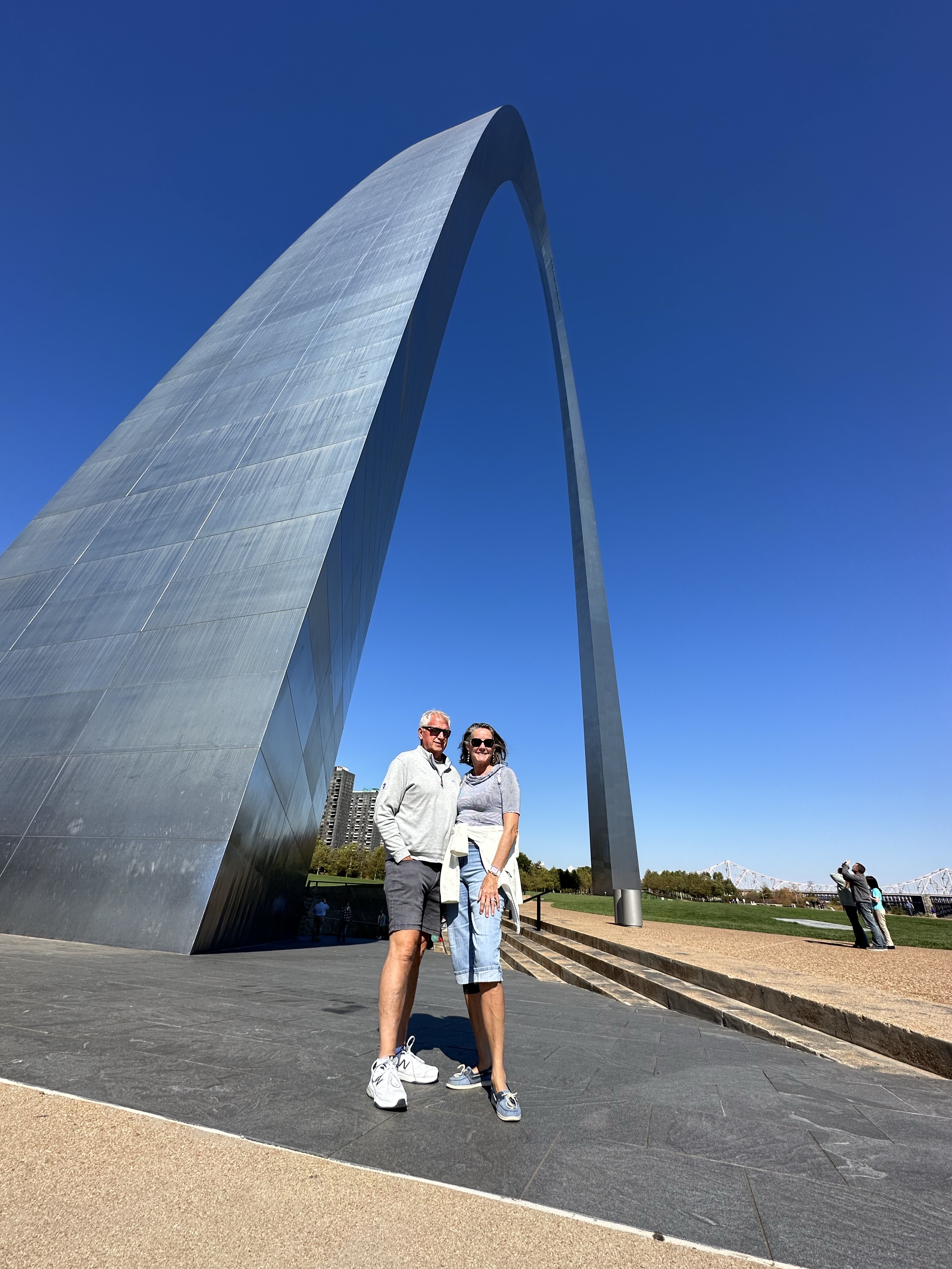
Alas, Rick had to work on Monday but Heidi was kind enough to return to the marina and pick us up for a driving tour of St. Louis (actually fairly sad as to the abandonment and decline of the city) – the gateway to the west that supplied the covered wagons and all the settlers needed for their journey into the Louisiana purchase. We ventured, of course, to the Gateway Arch and made the journey to the top in the 5 person miniature cars – an amazing system built inside of the arch inspired by elevators and ferris wheels. Going up was very cool, and the view quite impressive, but we have to say the highlight was the 30 minutes film in the Arch museum that chronicled the construction of the arch from February 1963 until its opening on October 28, 1965. 630 feet tall and 630 feet wide, it is designed to withstand earthquakes, lightning strikes and sways 18” in 150 mph winds. There are 1076 steps in each arch leg (thankful we didn’t have to walk them!) and a little known construction fact – despite what looked like zero OSHA rules and not a single worker tied off with a safety harness as they worked at great heights with cigarettes hanging out of their mouths, there was not a single fatality in the construction process.

The arch uses an “orthotropic design” that only became possible with advances in engineering in the late 50’s. If the arch had been built in 1948, the walls would have been 3 feet thick and would not have been able to accommodate a tram to the top. With an orthotropic design, the arch has no real structural skeleton. It’s inner and outer steel skins, joined together, form a composite load bearing structure that give it its strength.

After our amazing tour of the arch, it was back to the boat for a BOD meeting followed by a Captain’s meeting with the 13 boats who are planning to depart Alton for Hoppies in the morning. We have 2 locks to navigate and only half the boats have reservations at Hoppies – a small “marina” in Kimswick, MI run by the same family for generations. Hoppies is literally a few barges strapped together on the Mississippi; a must stop for loopers.

It was a very full 4 days and great to spend some time with Rick and Heidi seeing their adopted city of St. Louis. We were grateful for their generous hosting of us, doing touristy things they’ve done sooooo many times! Tomorrow we are off to brave the Mississippi and it’s huge barges again. We’ve traveled far in October trying to get south before the marinas close. The one we are in will shut down power and water next week. There are hundreds of loopers still behind us, so Godspeed to them!

Willow Island to Grafton where the Illinois River meets the mighty Mississippi

Day 150 – 152; Oct 18 – 20: We left our anchorage behind Quiver Island around 11:00 am, having waited to get started since there were tugs with barges in the locks. Carol had already been on her zoom call since 7:00 am, so Tonia joined Gary to handle the lines, fenders and anchoring. We proceeded to the La Grange lock where we anchored for about 30 minutes, waiting our turn. Gary and Tonia managed Legacy in to the lock, where we went down 8 feet. Carol’s break was timed perfectly so she was able to help get us off the wall of the lock and Tonia went back to her own boat. All worked out and then it was back to the Zoom call until 3:15 pm while Gary navigated on his own for a few hours. We arrived at our next anchorage behind Willow Island around 5:30 where magically, dinner was ready! Mayli and Boris made pork and chicken filled fried rice while Barb made a carrot and raisin salad as well as amazing white chocolate and macadamia nut cookies! Starship and Surprise joined as well with grilled chicken fingers and a salad.

This brought together 4 boys all between 11 and 12 years old who had a blast rowing a dinghy around with 2 dogs. What could possibly go wrong there? Well how about not tying up the dinghy when you take the dogs on shore? No worries – it was one of the Moms to the rescue on a kayak! Later, they had a blast chasing flies and little gnats in Legacy with the zapping tennis racket bug killing thingies…. We were quite grateful for their “work” and they had a blast….just little Huck Finn trick!

Willow Island Anchorage

Thursday, 10/19 was another early start for Carol (on Zoom by 7:30 am). Shortly after coffee and on a zoom break, we broke up the raft around 9:30 and headed to Grafton, arriving a little after 1:00, right when Carol’s call ended. Perfect timing! After everyone got settled and had a quick lunch, we were off to the Grafton Sky tour, a ski lift that takes you to the top of a hill where you can ride the Alpine coaster, do a zip line adventure or enjoy a full service restaurant with a big deck and view of the valley. We all enjoyed the Alpine Coaster that reaches speeds of 28 miles per hour while screaming around tight corners…. Or was that Carol screaming?…… anyway. We passed on the zip line being a 1.5 hour commitment with a hike between 4 different zip lines; that cold beer was calling very loudly at this point! Around 5:00 it was back down the ski lift while some headed to the restaurant and bar at the marina (Grafton Oyster Bar) and some took the marina courtesy car to the grocery store, but all ended up at the Oyster Bar later. Food was fabulous – highly recommend the seafood ravioli or the jambalaya.

We only spent one day in Grafton, which bills itself as the Key West of the Mid West. Kind catchy, but we weren’t so sure about that, although we did see lots of restaurants, bars, wineries and craft breweries.

Leaving Grafton, we crossed onto the mighty Mississippi River where we found the river 2-3 times wider than the Illinois with a lot more maneuvering room for both us and the tugs. We’ve been warned the barge configurations will be much larger and the traffic will be greater on the Mississippi.

Illinois meets mighty Mississippi

As we progress southward, the leaves are beginning to turn and we enjoyed the views of the quarries which provided 1000’s of jobs back in the day. Grafton stone was used to construct many buildings and homes in Grafton, but was also transported to St. Louis for use in structures like the Old Cathedral and the Eads Bridge.

Next stop Alton where we will spend a few day and use that as our home base to tour St. Louis. Hoping to visit with Rick and Heidi Vierstra (cousin) while we are here and of course get the obligatory picture of the boat in front of the arch.

Ottawa (Heritage Harbor) onto Peoria then to anchorage behind Quiver Island, North of Havana…. Still in Illinois!

Day 147 – 149; Oct 15 – 17: We were up early on Sunday morning before the sun with lines off at 6:45 am with 8 boats (members of flotilla 9 who chose to get up and go early plus remnants of flotilla 8). These were the brave ones who chose to make the 11+ hour 80 mile run to Peoria. We left in chilly weather with spitty rain headed to our first lock (Starved Rock) hoping to pass through the lock around 9:00 am.

Leaving as the sun came up

Upon arrival at the lock, they were locking through a large barge that was 3 barges wide and 5 barges long (a 3 by 5 in river talk!). We were instructed to anchor and await the barges clearing the lock. He was a big one – see below.

We started loading into the lock, per the lock masters instructions, with Legacy in first to tie onto the middle bollard; the next two largest boats came in after us, one in front and one behind. Then everyone else followed, rafting off one of the three boats with largest closest to the wall to smallest furthest out. This lock took us down 18 feet. Fun fact: Starved Rock got it’s name from a legend about a group of Illinois Indians who were trapped on the top of the rock by the Ottawa and Potawatomi tribes. The besieged Illinois were without food and water so were forced to surrender and were subsequently killed by their enemies…. Other versions of the legend say they died of starvation. Either way – gruesome death…let’s name a lock after it! This lock and dam were built between 1926 and 1933, part of the effort to provide a navigable channel between the Great Lakes to the Gulf of Mexico via the Mississippi River.

After passing through the Starved Rock Lock, it was another 7 hours of mostly industrial landscape, arriving in Peoria around 5:00 pm. Legacy arrived first and scoped out the space at the free wall off the Riverwalk in Peoria, just south of I74. Tucking into the municipal marina, we paced off the available slips and determined the rest of the flotilla could in fact fit into the various sized slips. Not the most well maintained marina and the power was not working, but we really didn’t much care. It was free, seemed relatively safe and it ended a long day!

It was also time to put the mast back up since we were done with too low bridges. Thankful for that!

Once everyone was tied up and secure, we headed off in search of a beer and dinner, finding Bill’s West Side Pub was open. Unfortunately, most restaurants and the places we wanted to see (Caterpillar Visitors Center and Riverfront Museum) were closed on Sunday and Monday, so we decided we’d stay just the one night and head out on Monday morning. We did get a walk in after breakfast to find the Richard Pryor statue (he was born in Peoria…who knew!) and the other statues along the statue walk on Washington Street, honoring the indigenous people.

By 10:30/11:00 am we were off again, headed under one railroad bridge then another lock. Peoria L&D lock took us down another 8 feet. Shortly after that lock we caught up with a tug (Ann Elise) pushing a large group of barges into an area known as “The Wiggles” because that section of the river was so curvy the tugs need to “wiggle” through it. We watched the Ann Elise navigate this section of the river and it was quite fascinating to see him turn that massive set of barges. See below!

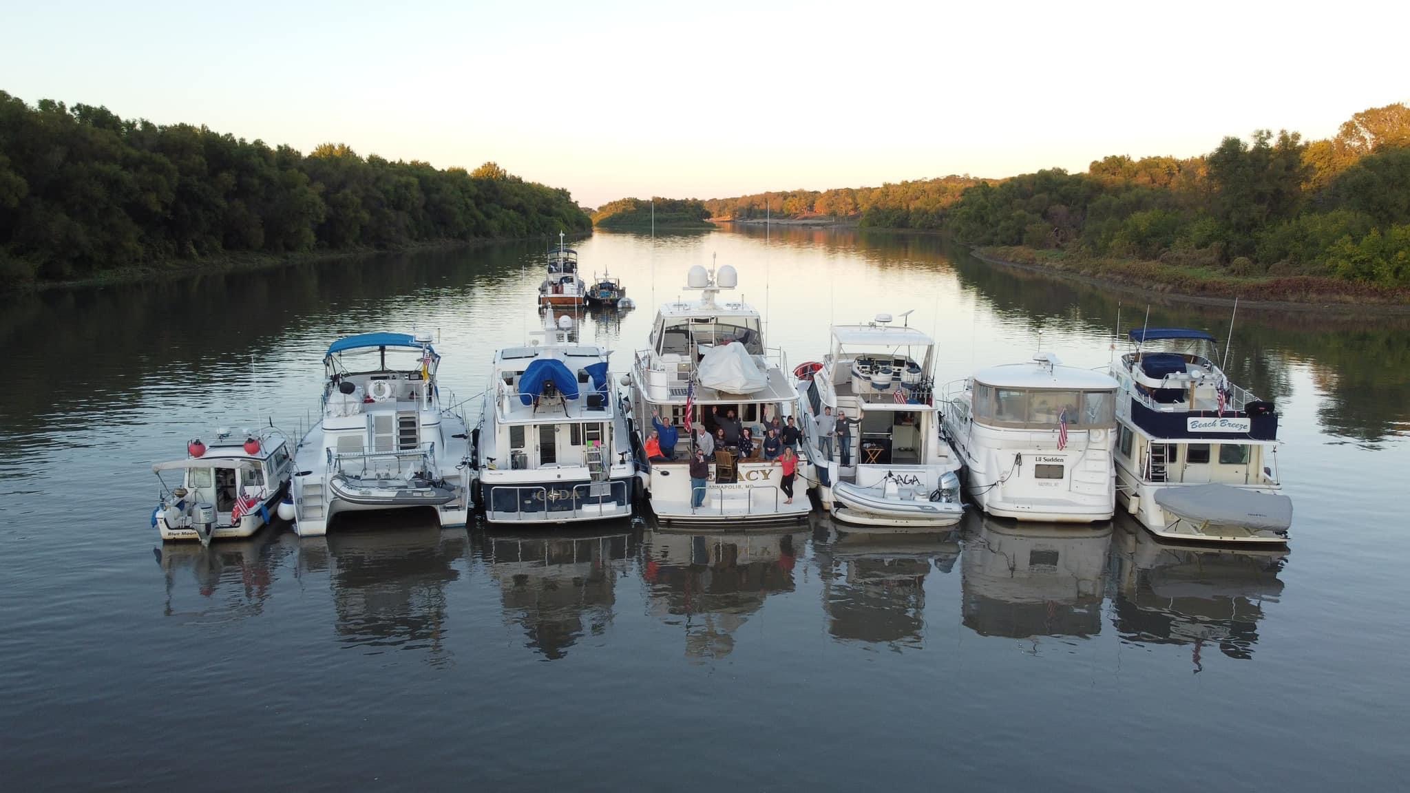
Jeremy at Heritage Harbor suggested an anchorage behind Quiver Island where we would find atleast 6 feet of water. Legacy was in the lead again (you might ask why….our cruising speed is about 10 knots while the other boats cruise in the 7.5 – 9 knot range)…. Anyway….. we got there first and entered this narrow area very cautiously, since we draw 5 feet and expected only 6 feet of depth. We were pleasantly surprised to find between 8 and 9 feet of water and a sailboat named Starship already anchored there. Jason on Starship called us on the radio and gave us the lay of the land…. So appreciated! We dropped anchor in the center and awaited the arrival of the rest of the flotilla: Coda, Lil Sudden, Saga, Darlyn, Blue Moon and Beachside. We rafted the other 6 boats, 3 on each side, with 3 anchors down while one more boat (Surprise) rafted with Starship. Surprise could have joined us as well, but we later learned they were friends with Starship and planned this rendezvous all along!

It was a super nice night, albeit a little chilly, where we started off with queso, bean dip and chips followed by fish tacos with mango slaw and rice. All activity was in the cockpit and salon of Legacy – party central! Carol had done all of the prep for the tacos on the way, using ingredients from just about every boat in the flotilla. Barb also made the rice and bean dip. At “go time”, Tonia got the slaw ready while Gary manned the skillet. The prep paid off and a meal for 13 came together very quickly and was then topped off by a surprise peach, apple and pear cobbler made by Barb! That brought out the last of the vanilla ice cream the Z’s had in the freezer (an added surprise). No one left hungry!

Tuesday, 10/17 we awoke to a 38 degree morning and mist rising from the water. Coffee was again served on Coda where we talked Steve into using his new fancy gas powered super large griddle to make breakfast for everyone. It was bacon, homemade hash browns and scrambled eggs with cheese. YUM and thank you to Steve and Barb!

After breakfast it was time to head to Beardstown, about a 33 mile run, where we could raft to the Logsdon Tug Service barges for $1.00/foot cash, no power. Sounded great! We were on our way around 10:30 am and arrived in Beardstown a little after 2:00.

The last leg required that we pass under a bridge but a large assembly of barges pushed by a tug was coming through. We waited for them to pass. Check out how large they are and how close we were!

The captain and deck hand at the tug were kind enough to give us a quick tour of the tugs before they were off to help a barge coming through the channel. After that, we were off to find ice cream, dinner at a local Mexican restaurant and provisions. We ended our very busy day on the boats with a beautiful sunset.

Tomorrow we are off to Willow Island and the power of friends has kicked in. Carol has 2 days of all day meetings on Wednesday and Thursday. Tonia from Lil Sudden is going to join us on Legacy to assist with the locks while Annette from Saga (13) will join Matt on Lil Sudden to do the same while Carol is in her meeting. We need to get all 3 boats through the locks with the right eyes on computer screens vs. eyes and hands on lines and locks. Super thankful for the help!!